eMotion
Advanced, scalable software
A drone’s flight management (or ground station) software defines your experience—if this is complicated or confusing, operations can quickly become a chore. eMotion is different: it’s advanced, scalable drone software that anyone can use
Need a Quote?
We’ll Call You
Simply enter your contact details and one of our specialists will call you to discuss your requirements and provide a detailed quotation.
Need a Quote?
We’ll Call You
Simply enter your contact details and one of our specialists will call you to discuss your requirements and provide a detailed quotation.

Drone flight planning software
eMotion flight planning software brings simplicity and power to your drone operations. Designed to streamline mission creation, automate key tasks and support real-time interaction with your aircraft, it helps you plan, fly and manage data with confidence across every stage of your workflow.
Automated data capture workflow
eMotion streamlines aerial data collection with an intelligent, end-to-end workflow designed to improve efficiency and reduce operational effort. From planning to post-flight readiness, it supports consistent, reliable results across a wide range of professional mapping applications.
Need a Quote?
We’ll Call You
Simply enter your contact details and one of our specialists will call you to discuss your requirements and provide a detailed quotation.
Need a Quote?
We’ll Call You
Simply enter your contact details and one of our specialists will call you to discuss your requirements and provide a detailed quotation.

1. Flight plan creation

2. Autonomous geotagged data capture

3. Postflight process (PPK)
4. Data ready for post-processing and analyses
Simplified mapping for every user
Beginner-friendly yet packed with advanced features to tackle the toughest jobs, eMotion simplifies every step of your mapping project, helping to get your eBee in the air quickly, so you can focus on what’s important – analyzing geospatial data.
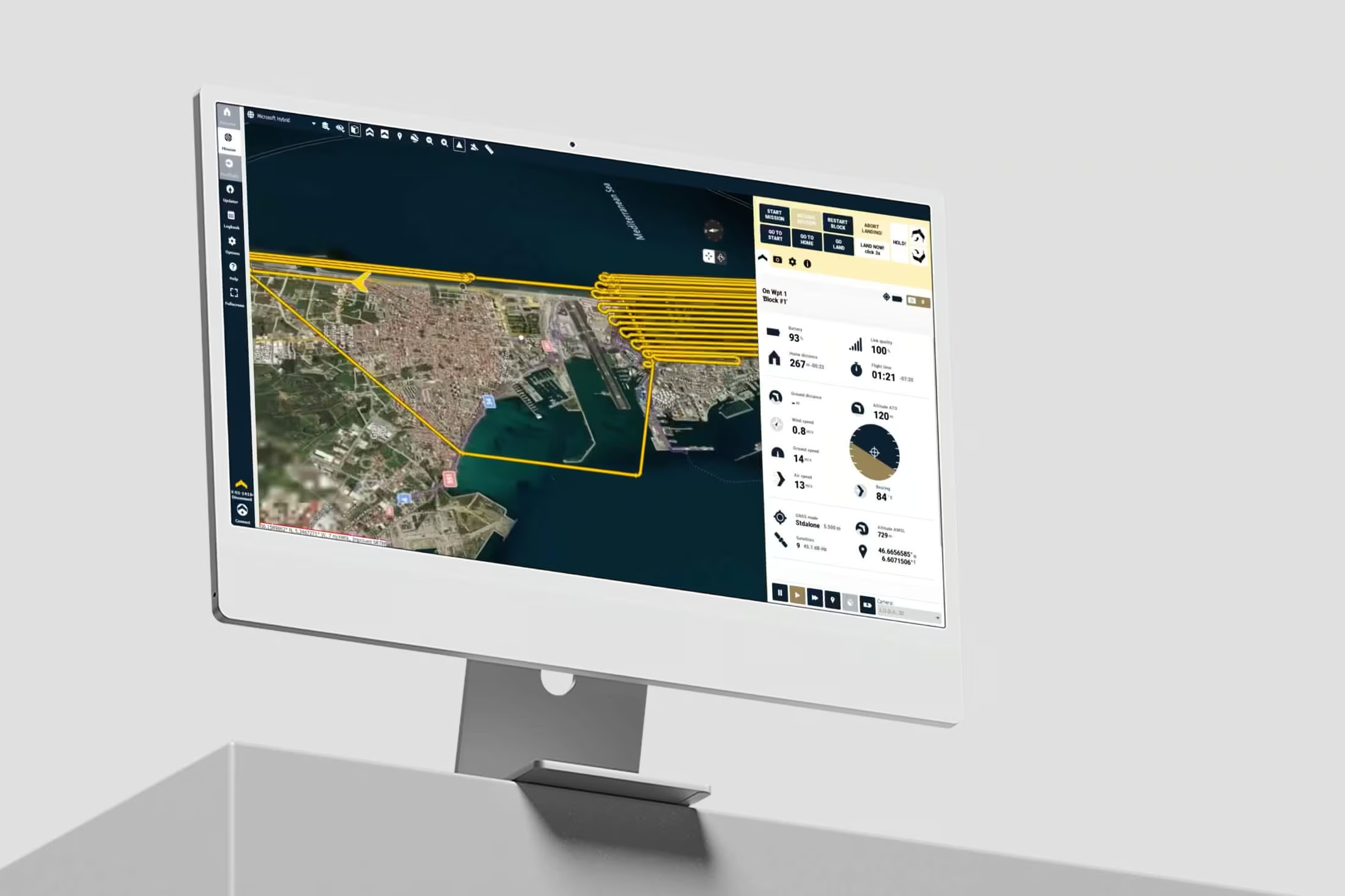
Flight plan autogenerated
Draw the area you want to map and eMotion creates the flight plan.
Optimized flight modes
Horizontal, corridor, point of interest (POI), multiple and custom.
Preset or custom settings
Adjust the mission parameters or select the optimized preset settings for the project type, the camera used, and the terrain.
Suits various industries
Agriculture, utilities, environmental, surveying, mining, humanitarian, governmental, disaster management, coastal and more.
Flight simulator
Flying experience recreation with included RTK/PPK. Possibility to modify parameters to see their effect on the drones.
Mission creation in 5 minutes
Just a few minutes are needed to prepare a simple mission, with the possibility to choose optimized presets or custom settings – GSD, overlap, etc.
Real time info
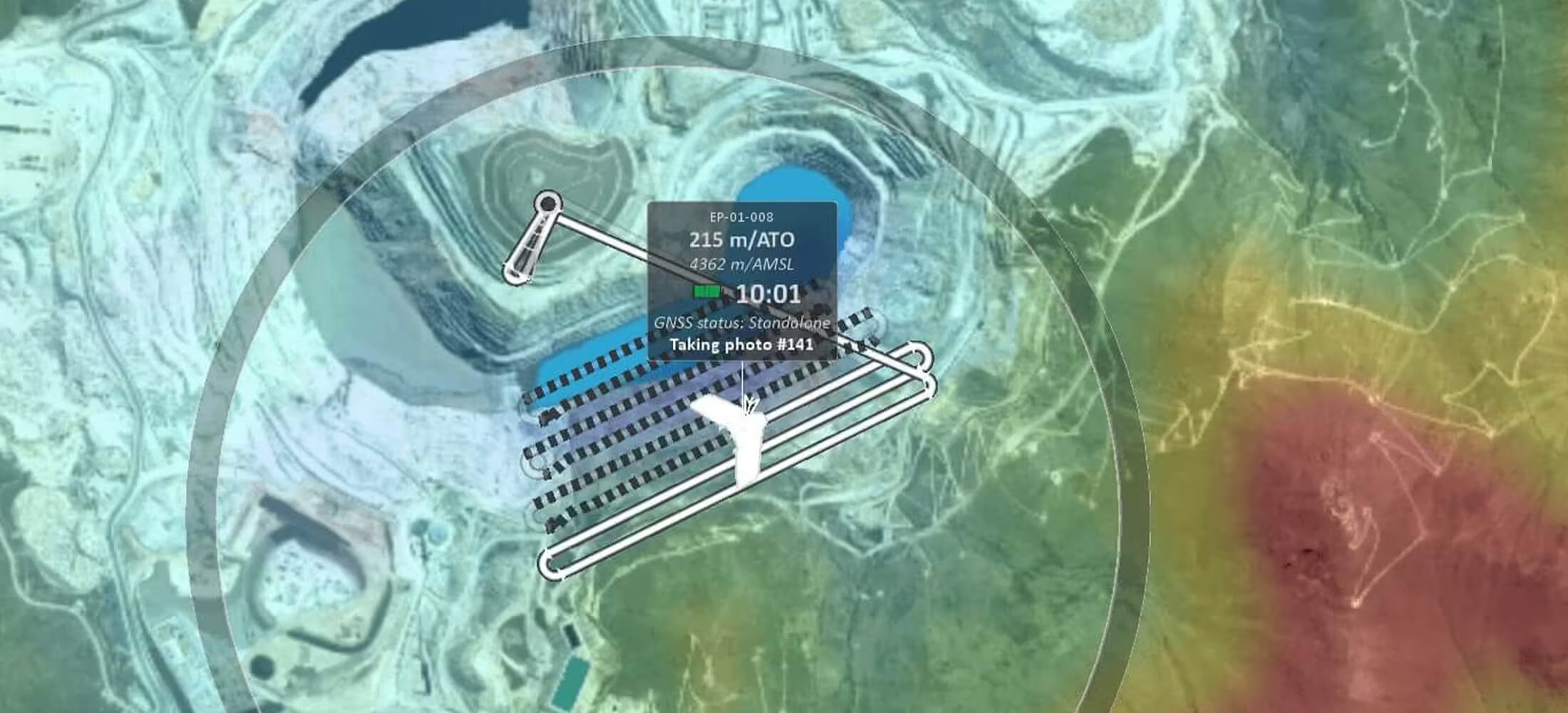
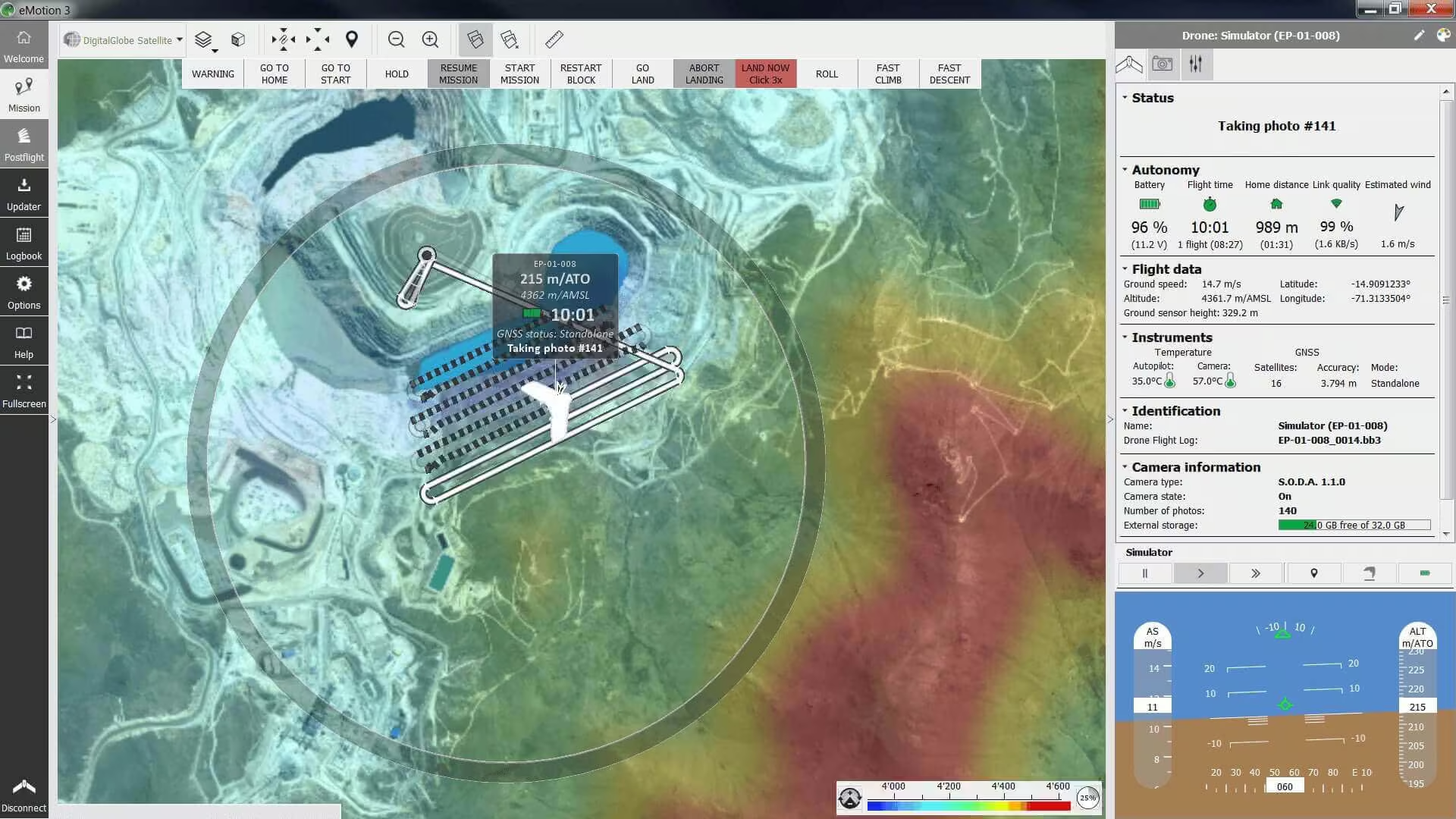
Drone battery level, home distance, link quality, flight time, altitude, wind, ground and air speed, and more.
Geotagged images
Images are automatically geotagged during flight to provide you with a time-saving advantage in post-processing.
Safety features
eMotion safety features contribute to the regulation advantages that our drones provide to eBee operators, such as BVLOS and Operations Over People approvals.
Need a Quote?
We’ll Call You
Simply enter your contact details and one of our specialists will call you to discuss your requirements and provide a detailed quotation.
Need a Quote?
We’ll Call You
Simply enter your contact details and one of our specialists will call you to discuss your requirements and provide a detailed quotation.
Interaction during drone flight
Modify a flight plan or send commands anytime during a planned mission.
Airspace management
Import geo-awareness maps to have all the restricted and no-fly zones on your flight map.
Notifications and warnings
Audio and color-coded notifications – advisory, caution and critical – before and during flight.
Safety Actions
Taken by the drone
When detecting strong wind, low light, lens cap on, GNSS accuracy degradation and more, the drone will automatically return to home for landing.
Available to the operator
During flight and with just a few clicks, modify the path, the landing spot, hold drone in position, resume mission, perform an emergency landing and more.
Multi-environment mapping
eMotion supports versatile mapping workflows with tools for 2D and 3D visualization, custom backgrounds and terrain-aware flight planning. These capabilities help operators adapt to varied environments and capture accurate geospatial data for professional analysis and monitoring.
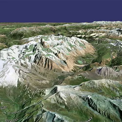
2D and 3D
Activate the mode you prefer to navigate the map and visualize the terrain more accurately.
The elevation color map also helps you check site elevation and plan your flightlines accordingly.
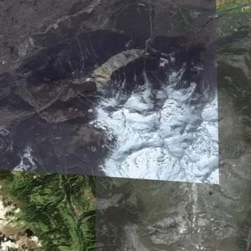
Custom background
Use included eMotion maps, import KML files or create your own.
Custom maps are ideal for recurrent mapping projects and for monitoring changes over a period of time.
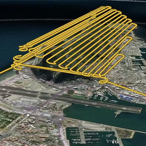
Terrain following
eMotion enables by default terrain following, but you can also import your own elevation data easily.
The software allows exporting your KML trajectory to check in Google Earth Pro.
Online and offline use
eMotion is designed for flexible operation in both connected and offline environments, ensuring reliable mission planning and data capture regardless of field connectivity. Built-in fail-safe protocols maintain operational continuity in the event of temporary link disruptions, supporting secure and efficient aerial mapping workflows.
Need a Quote?
We’ll Call You
Simply enter your contact details and one of our specialists will call you to discuss your requirements and provide a detailed quotation.
Need a Quote?
We’ll Call You
Simply enter your contact details and one of our specialists will call you to discuss your requirements and provide a detailed quotation.
Online
eMotion connects wirelessly to your drone, to industry cloud solutions, to survey-grade base stations, airspace data, and even includes live weather updates.
Offline
Are you planning a flight, but you won’t have Internet connectivity in the field? Simply download map data for offline use in advance/at the office and use it on-location without the Internet.
Radio link
If the connection between eMotion and the drone is momentarily lost, the eBee continues the mission, taking photos as planned, and lands. When the radio link is lost for more than 5 minutes, the drone returns home and lands.
Images prepared for post-processing
eMotion automatically handles the georeferencing and preparation of images required for post-processing software. This vastly reduces third-party software compatibility issues.
Compatibility
With fleet management software, base stations, and photogrammetry post-processing software:
Measure Ground Control, DroneLogbook, PIX4Dmapper, PIX4Dmatic, PIX4Dcloud, PIX4Dreact, PIX4Dfields, PIX4Dsurvey, Agisoft Metashape, DroneDeploy, Bentley ContextCapture, SimActive, Esri ArcGIS Drone2Map and Trimble Business Center.

Software requirements
-
OS 64-bit only
-
Microsoft Windows 7
-
Microsoft Windows 8
-
Microsoft Windows 10

Drone flight & data management.
eMotion simplifies drone operations with automated planning, mission simulation, reliable flight execution and streamlined data export. Designed to improve efficiency and operational control, it supports professional geospatial workflows from preparation to analysis.
Plan
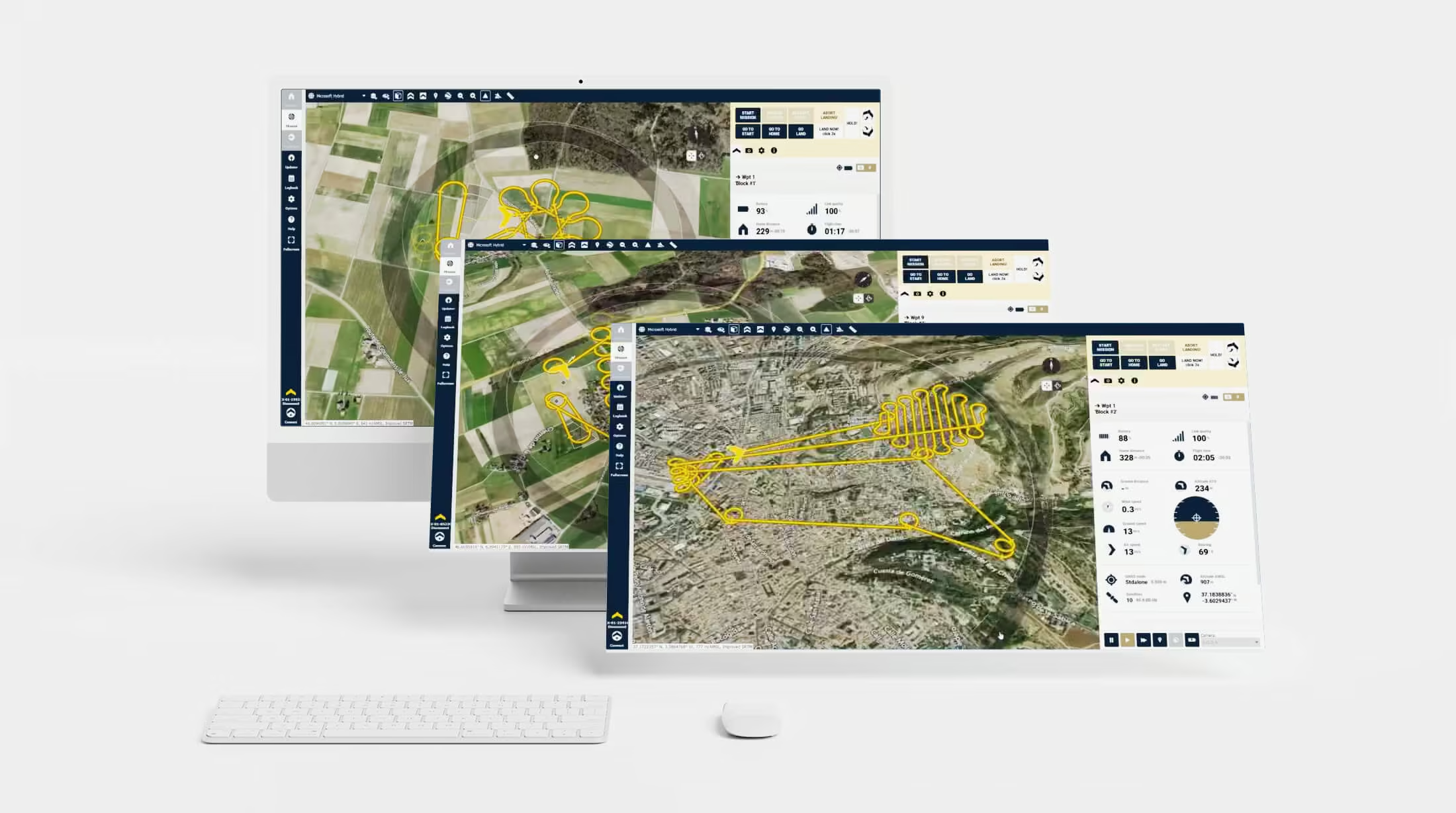
With eMotion, flights are built using mission blocks. Just choose your block (aerial mapping, corridor etc.), highlight the region you want to map, define key settings, and eMotion auto-generates your drone’s flight plan.
Multi-flight missions are supported and you can activate/import elevation data for even safer, terrain-accurate flights.
Simulate
eMotion’s Simulator mode helps you to optimise your flight plan and explore the functions of your senseFly drone. Just enter the wind strength and direction, then press Play to ‘launch’ your drone.
Now you can view all aspects of your flight as the drone flies its mission
Fly
Upload your flight plan wirelessly to your drone. After a simple hand launch, eBee fixed-wing drones then fly, capture images, and land themselves.
For albris, choose between an automatic mapping mission or eMotion’s Interactive ScreenFly mode for live inspections.
Export
eMotion’s built-in Flight Data Manager automatically handles the georeferencing & preparation of images required for post-processing in software such as Pix4Dmapper (vastly reducing third-party software compatibility issues)
See the eMotion in Action
Discover how eMotion streamlines drone flight planning and data workflows in real-world demonstrations, showcasing intuitive mission preparation and efficient operational performance.
Related Images




Need a Quote?
We’ll Call You
Simply enter your contact details and one of our specialists will call you to discuss your requirements and provide a detailed quotation.
-

Corridor
The Corridor is a combined S.O.D.A. and eMotion software solution that makes corridor mapping easy. -

S.O.D.A.
The S.O.D.A. is the first photogrammetry camera to be built for professional drone use and has quickly become the reference sensor in its field. -

Duet M
The Duet M is an innovative dual-purpose RGB and multispectral mapping camera rig. -

Aeria X
This rugged innovation offers the perfect blend of size, weight and DSLR-like image quality. It offers stunning image detail and clarity, in virtually all light conditions. -

S.O.D.A. 3D
The S.O.D.A. 3D mapping camera is a professional drone photogrammetry camera that changes orientation during flight. -
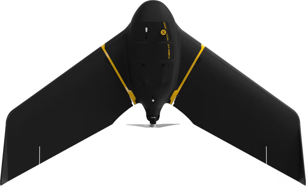
eBee X
eBee X offers 90-minute flights, RTK, PPK, online training, eMotion flight planning software, and more.