Contact OPTRON to find out more about our complete range of Underground Mining Solutions!
How Gel Survey Solutions mastered a sub-millimetre challenge with the Trimble SX12
When Ivanplats embarked on developing its site near Mokopane in Limpopo province, the objective was ambitious: establish what is set to become one of the world’s premier primary platinum group metals (PGM) mines. Unlike traditional South African platinum deposits, which typically stretch across narrow reef layers around a meter thick, the Mokopane orebody presents a massive, highly valuable deposit extending roughly 22 metres in vertical thickness. Mining on this scale demands high-capacity infrastructure, including a vertical shaft capable of clearing massive volumes of rock, 24 hours a day.
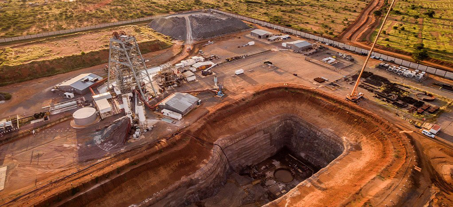
Aerial view of the Shaft 2 box cut at IVANPLATS – early works with the concrete hitch under construction
Against this backdrop, Michiel (Giel) Geldenhuys, founder and director of Gel Survey Solutions and a veteran with 33 years’ experience in specialised surveying across civil, mechanical and deep underground engineering, was tasked with managing survey operations for the mine’s critical vertical shaft project.
The task involved equipping a 950m deep, 5.1m diameter shaft that had been created using a raise-bore machine. Initially intended solely as a ventilation pathway, the shaft was redesigned to house two high-speed skips operating at 15 m/sec. However, turning a raise-bore hole into a high-speed extraction shaft presented severe technical challenges.
Severe Subsurface Conditions
Traditional vertical shaft surveying relies on physical plumbing wires and tape brackets lowered down the shaft to maintain positional control. However, conventional methods proved completely unviable at Mokopane due to a combination of severe factors.
To maintain underground air quality, an aggressive downdraft system blew air down the shaft at roughly 10 m/sec. Plumbing wires require steady air speeds below 1 to 2 m/sec to prevent significant sway and positional error. In addition to the draft, continuous heavy water ingress created extreme water and humidity levels. Furthermore, as the raise-bore drill had encountered varying rock densities during drilling, the hole drifted from true vertical by nearly 500mm over its 950m depth. Despite these environmental hazards, the steel guides (acting like vertical railway tracks for the skips) required a precise installation tolerance within +1mm to +2mm to ensure safe operation at high speeds.
“You’ve got all this wind and all this water,” Geldenhuys explains. “It’s like standing in a 40 km/hr wind with an instrument set up and water pouring all over you… It was extremely harsh conditions.”
With turning off the ventilation out of the question due to operational safety across the broader mine, Geldenhuys rejected traditional methods and turned to an innovative approach powered by the Trimble SX12 Scanning Total Station.
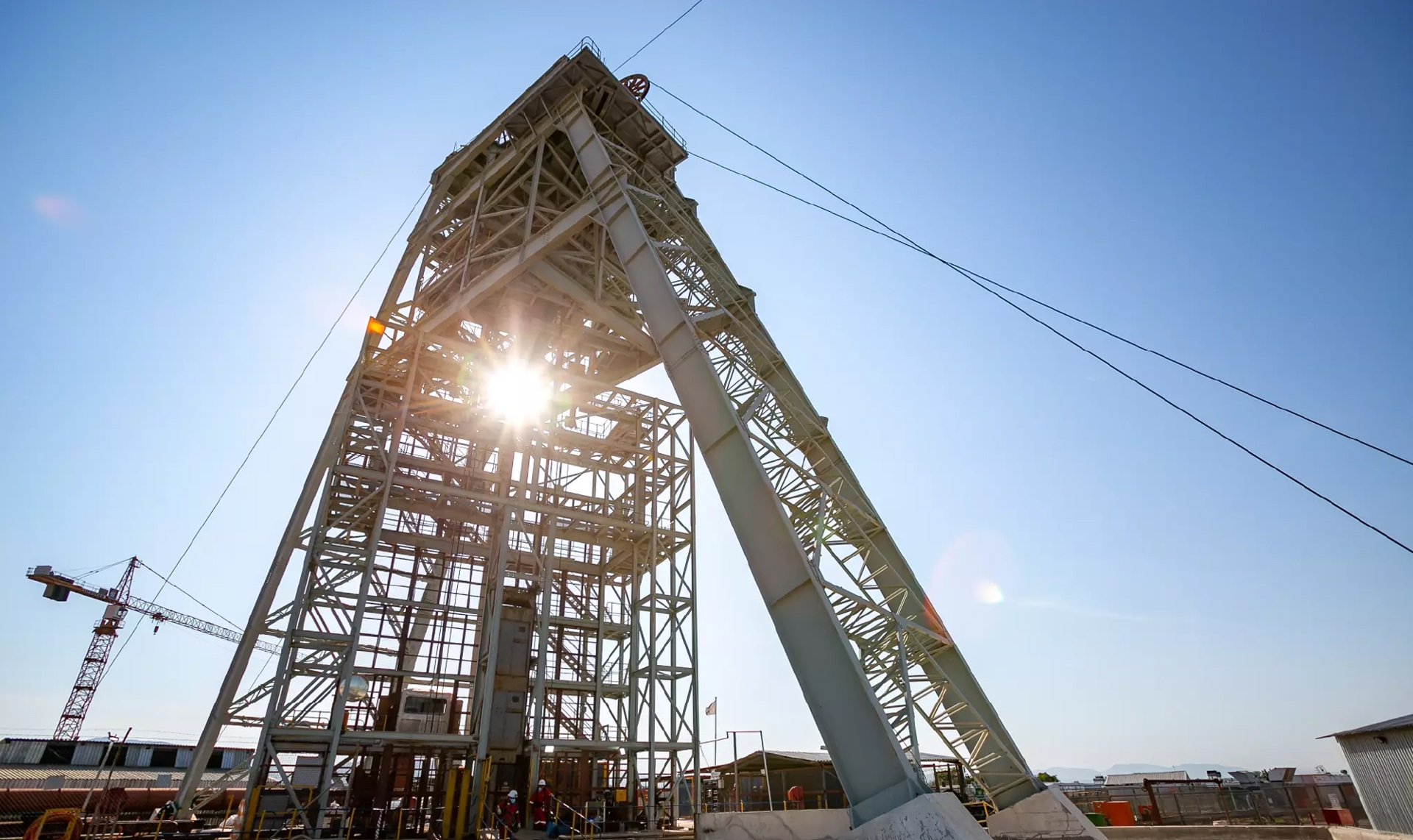
Shaft 1 headframe at Ivanplats
Innovative Surveying with the Trimble SX12
Working alongside OPTRON (Pty) Ltd, the authorised distributor of Trimble Geospatial solutions in Southern Africa, Gel Survey Solutions executed a novel surveying strategy inside the shaft.
Instead of relying on suspended wires, the team carried out vertical 3D scans from top to bottom, anchoring secure control points equipped with prisms on sidewall brackets every 20 metres. Using the scan data, Geldenhuys computed the true centre of the shaft at every 6-metre ‘lift’. From there, the team executed resections to install precise wall pegs. These pegs gave the construction crews immediate reference points to set fish lines and align the structural steelwork accurately.
“I used the scan data to establish the true centre of the shaft every six metres as we descended,” explains Geldenhuys. “We plotted those coordinates theoretically, then went back down to perform resections and stake out the exact centre point at six-metre intervals, setting four sidewall pegs that the crew used to align the steelwork.”
To verify each step, Gel Survey Solutions deployed a second instrument, a Trimble S7 Total Station, to perform parallel verification checks against the primary SX12 data.
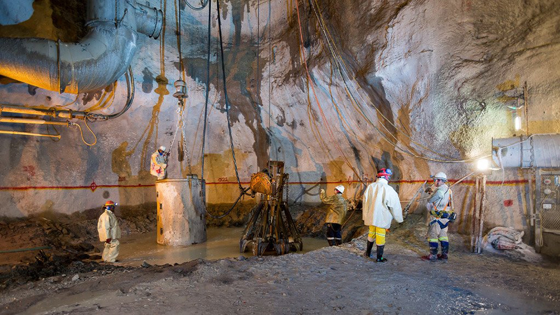
Mine workers at shaft bottom – 850m below ground level
Engineering Excellence Under Pressure
The Trimble SX12 delivered several distinct operational advantages in this extreme underground environment. Its integrated camera system and video feed provided direct digital targeting, eliminating the need for surveyors to look through an optical eyepiece when sighting overhead control points. Featuring an IP55 ingress rating, the robust hardware handled fine dust and heavy moisture easily, while field controllers were kept sealed inside protective bags to prevent water damage.
The total station operated fully robotically via MagDrive™ electromagnetic direct drive technology, tracking targets automatically without physical touch and reducing the risk of accidental disturbance. Additionally, pairing 1″ angular specification with a 1.5 mm scanning accuracy allowed the team to capture exceptionally detailed point clouds at a rate of up to 26.6 kHz without sacrificing precision.
Heinrich Coetzee, Regional Sales Manager at OPTRON, notes that technical support played a crucial role in maintaining site operations. When the primary unit required scheduled workshop maintenance, OPTRON provided a replacement unit within 24 hours to keep the project on track.
“The backup and support I got from OPTRON was a crucial part of this whole success story,” Geldenhuys notes.
Quantifiable Results and Operational Impact
By replacing physical plumb lines with total station scanning, Gel Survey Solutions turned a complex structural challenge into an efficient, repeatable workflow.
The shaft equipping was successfully completed within the 14-month timeframe, finishing ahead of schedule owing to streamlined reference layout. Structural steel guides were installed within the strict +1mm tolerance, allowing the shaft to be cleared for 15 m/s skip operations. In general mine development, loading 3D design files directly onto field controllers enabled live deviation checks right at the face. This caught undercutting or off-grade mining immediately, avoiding expensive re-mining and reducing reworks. Furthermore, point clouds were integrated into the mine’s 3D spatial models every two to three days, establishing a seamless field-to-office data flow that gave site engineers an updated view of underground operations.
“By doing this, it saved a lot of time because now everybody had reference to exactly what to do,” Geldenhuys highlights. “We actually finished the shaft ahead of schedule because we saved a lot of time thanks to the SX12 Scanning Total Station.”
Additionally, operating the SX12 robotically kept surveyors at a safe distance from hazardous shaft conditions while providing instant 3D data, keeping the underground survey team safe.
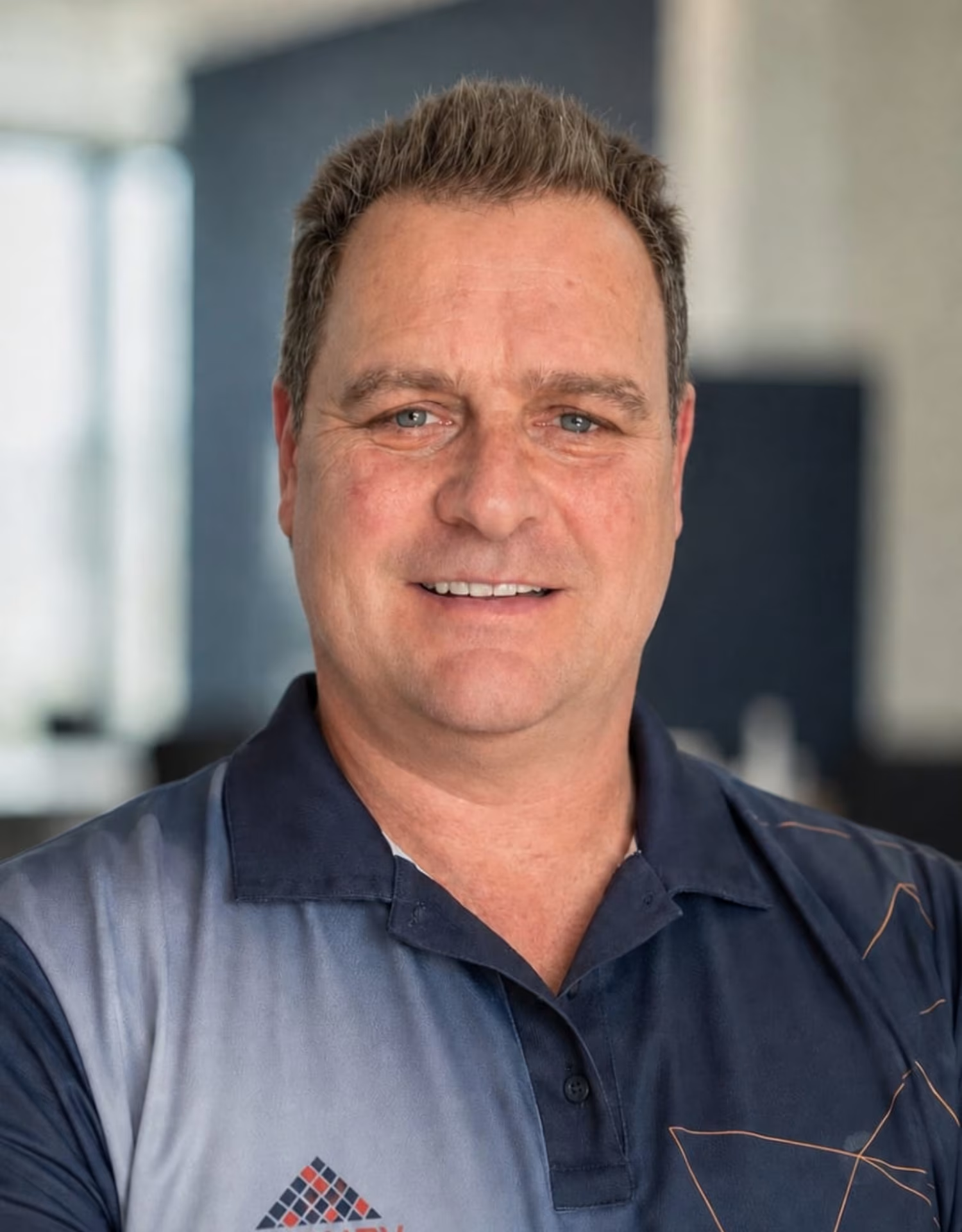
Michiel (Giel) Geldenhuys, owner and director at
Gel Survey Solutions
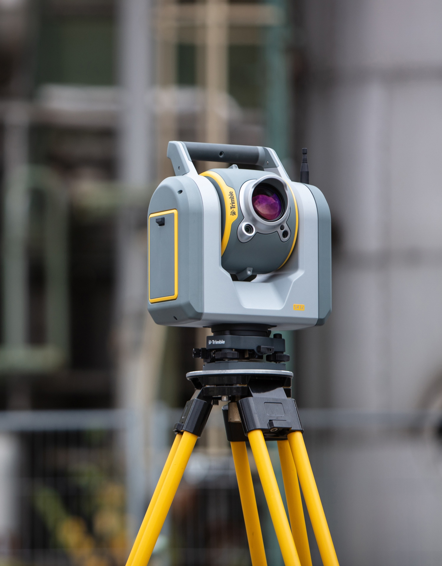
Trimble SX12 Scanning Total Station
Setting a new Industry Benchmark
The success at Mokopane highlights a shift in deep-level mining survey techniques. By pairing high-precision spatial scanning with robust field software, Gel Survey Solutions proved that optical and laser scanning total stations can replace traditional wire-plumbing, even under severe environmental conditions.
As mines push deeper and adopt digital workflows, real-time connectivity, such as transferring design files straight from the office to instruments via Trimble Connect, is fast becoming the standard for efficiency and site safety.
Looking back on what they achieved, Geldenhuys is clear that nothing else on the market even comes close to the Trimble SX12, especially after watching it thrive for a whole year in conditions most surveyors would avoid.
The triumph at Mokopane does more than just rewrite the rulebook for deep-level mining in South Africa; it proves that when you pair clever engineering with the right technology, you can conquer the toughest environments and nail sub-millimetre precision, repeatedly.
– Kim Kemp
Contact OPTRON to find out more about the Trimble SX12 Scanning Total Station and our complete range of Geospatial Survey Solutions.